 |
 |
 In more than 30 years as an archaeologist, I've worked in Jordan, Israel, Egypt, Greece, Morocco, Ireland, Cyprus, and the U.S. Southeast and Southwest. I have considerable experience in GIS, spatial and mortuary anlysis, computer systems analysis, data management and computer programming. I'm the director of the Geo-Archaeological Information Applications (GAIA) Lab at the Archaeological Research Institute (ARI) at Arizona State University and the IT Manager for ARI.
GAIA Lab Receives NASA Space Archaeology Grant
As of July 1st, 2010, the GAIA Lab will receive funding from NASA's Space Archaeology program for our project, "Climate Change and Human Impact on Ancient and Modern Settlements: Identification and Condition Assessment of Archaeological Sites in the Northern Levant from Landsat, ASTER and CORONA Imagery." This project will conduct archaeological site prospecting and condition assessment with two methods that utilize Landsat TM, ASTER and CORONA imagery from Lebanon and southwestern Syria. The causes of the Early Bronze Age (ca. 3600-2000 BCE) collapse will be assessed through statistical analysis of settlement pattern data derived from remotely sensed data from the northern Levant, compared to the much better-known settlement systems in the southern Levant. The project will use supervised classification and other image analysis software to find archaeological sites from space and compute precise site location and area dimensions. Site polygon centroids will be used to perform a nearest-neighbor analysis to match remotely-sensed sites to published site names, correct their point coordinates, and record site sizes, using a published inventory whose site locations were recorded only to the nearest kilometer. Collected over a period of about thirty years, satellite imagery can document changes in land cover and development on archaeological sites. Modern site damage will be assessed by comparing the development on sites from CORONA images of the late 1960s-early 1970s to more recent imagery, thus quantifying aspects of land cover change related to development on archaeological sites. You can read about the NASA Space Archaeology program and our successful proposal by pressing the "Space Archaeology" button on the left.
NASA Space Archaeology Report
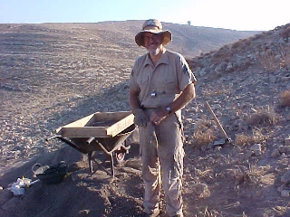
 The Final Report for the GAIA Lab's NASA ROSES Space Archaeology grant (09-SAP09-9) can be viewed online bly clicking the imiage shown here. This study has significantly enhanced current methods of archaeological site prospecting through the development and refinement of techniques that make use of Landsat TM, ASTER, Google Earth, and CORONA imagery. The innovative use of ImageJ software, an open-source program developed for analysis of medical tissue thin sections, to archaeological site prospecting is especially exciting. The method, developed by Rempel, is innovative and cost-effective, and can be applied to broad regions outside our immediate study area to significantly increase our knowledge of archaeological site inventories, though it still needs some refinement to eliminate as many false positives as possible.
The impacts of agriculture, warfare and the explosive development of urban areas and their supporting infrastructure have had an extremely adverse effect on archaeological resources in the Middle East. It has been especially severe in Lebanon, which has experienced a civil war and several incursions by the IDF in the forty-year period that spans the production of the satellite imagery to be used by this study. Our methods for discerning site footprints and of assessing the amount of development and that has occurred on archaeological sites have documented this damage in a quantitative manner. This information helps provide a knowledge base of “sites at risk” and thus helps to target specific preservation efforts.
The ultimate archaeological results of this study, which will be developed in Rempel's Ph.D., dissertation, are expected to revolutionize our current understanding of the development and decline of human communities at the end of the Levantine Early Bronze Age, and their resurgence in the subsequent Middle Bronze Age. EBA communities in the southern Levant favored adaptive strategies that preserved flexibility and autonomy over those that emphasized maximum productivity. They never fully relinquished the flexibility needed to adapt to economic downturns and periods of political instability, resisting full integration by maintaining a diverse subsistence base and a high degree of autonomy. South Levantine EBA people and communities established long-term social and environmentally adaptive responses that enabled them to endure repeated cycles of systemic collapse and regeneration. Their patterns of adaptation and hardiness continue to resonate in the modern Middle East (LaBianca 2009). This study will help document the similarity of these south Levantine adaptive patterns to larger regions of the Levant.
MedArchNet and the Digital Archaeological Atlas of the Holy Land
The GAIA Lab is now working closely with Thomas Levy's UCSD Levantine Archaeology Laboratory, the California Institute for Telecommunications and Information Technology (Calit2) at UCSD and the UCSD Supercomputing Center to develop the Digital Archaeological Atlas of the Holy Land. This project will unify disparate datasets for Jordan, Israel, the Sinai Peninsula and southern Lebanon.
As part of the Space Archaeology project, the GAIA Lab placed the newly acquired and corrected archaeological site information in the Digital Archaeological Atlas of the Holy Land. This lets the site data be viewed by the public and preservation professionals on a web portal, through Google Maps and Google Earth API tools. The DAAHL database currently contains more than 18,000 archaeological sites in the Levant, and continues to expand with the incorporation of major data sets contributed by an international group of researchers from Jordan, Israel, the Palestinian Territories, Great Britain, Norway, Canada and the United States. Placing the data from Lebanon and Syria into the DAAHL database has significantly raise the profile of archaeological studies in Lebanon, and raised public awareness of the importance of site preservation in this important region of the Middle East. Specifically, this will have a significant impact on how the site data is disseminated and used. Ultimately, the data-sharing model developed for the DAAHL node in the MedArchNet will have applicability for any group interested in building cyberinfrastructures for world cultural heritage around the world in regions such as North and South America, India and China.
Doc Savage's Old World Archaeology Page
This site is devoted primarily to resources for the southern Levant, including Israel, Jordan and the Palestinian Territories. You can download a lot of digital data, including:
- 1:50,000 scale topographic maps of the southern Levant;
- LandSat 28m resolution 5-band satellite images of the southern Levant;
- NIMA-SPOT satellite imagery for the southern Levant;
- Digital Chart of the World data for the Middle East.
You can also download two programs I've written, including:
- The ReprojectME! Program, for reprojecting shapefiles and coordinates between about 30 map projections common to the Middle East;
- The RankSize Simulation Program, for analyzing archaeological site distributions and making rank-size plots;
There is also some information about my ongoing field project, the Moab Archaeological Resource Survey, including reports to the Jordan Department of Antiquities for recent field seasons.
These are the highlights of the page, but you can also look at a lot of other stuff, such as my vita, abstracts of some published articles, and data from the Predynastic Egyptian cemetery at Naga-ed-Der and the text of a successful National Science Foundation proposal to conduct an extensive radiocarbon dating program in the cemetery.. Press one of the buttons on the left, or one of the links above. Enjoy!