


The Geo-Archaeological Information Applications Lab
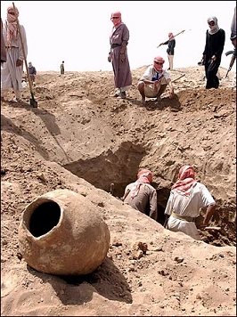
in their search for black-market antiquities.
The combined impacts of population growth, rapid planned and unplanned development, looting and warfare in many parts of the world have placed tremendous pressure on cultural resources and on the government agencies responsible for managing them. Thousands of known historically significant places and archaeological sites are threatened by these forces; untold thousands more await discovery, preservation, and development. It is a daunting task that requires the application of modern methods of data management and retrieval. The task is aptly suited for solutions based on Geographic Information Systems (GIS), database and Web-based technology.
The GAIA Lab specializes in developing and deploying integrated GIS standalone and web-based databases for managing cultural resources and other large-scale spatial datasets, using the latest web mapping methods, including Google Maps and Google Earth, powered by AJAX, PHP, KML, JavaScript and MySQL. The lab is affiliated with the Center for Cyber-Archaeology & Sustainability, Qualcomm Institute, University of California, San Diego, and the Capitol Archaeological Institute, George Washington University, Washington, DC. The lab's activities have been funded by grants from the National Endowment for the Humanities, the National Science Foundation, NASA, the American Schools of Overseas Research, the American Center of Research in Amman, Jordan, the University of California, the World Monuments Fund, the Getty Conservation Institute, and the Kaplan Foundation. Early grants also came from the Egyptian Studies Association at the University of South Carolina and Sigma-Xi.
The Palimpsest and the Simulacrum
Through software such as the ReprojectME! program (see "Programs" on the link bar), and web based initiatives like the Digital Archaeological Atlas of the Holy Land and TerraWatchers (see "Projects" and "Space Archaeology" on the link bar), the lab collapses the distance between the ancient landscape and the modern digital user. By mapping the coordinates of vulnerable human heritage onto the algorithmic gaze of Google Earth and Google Maps, the lab creates a post-physical palimpsest where history is both archived and actively defended. It operates as a site of techno-resiliency, where the fragile, threatened boundaries of sacred and historical space are codified into relational tables, ensuring that even as the physical landscape is pillaged, its mathematical ghost remains as a digital simulacrum.
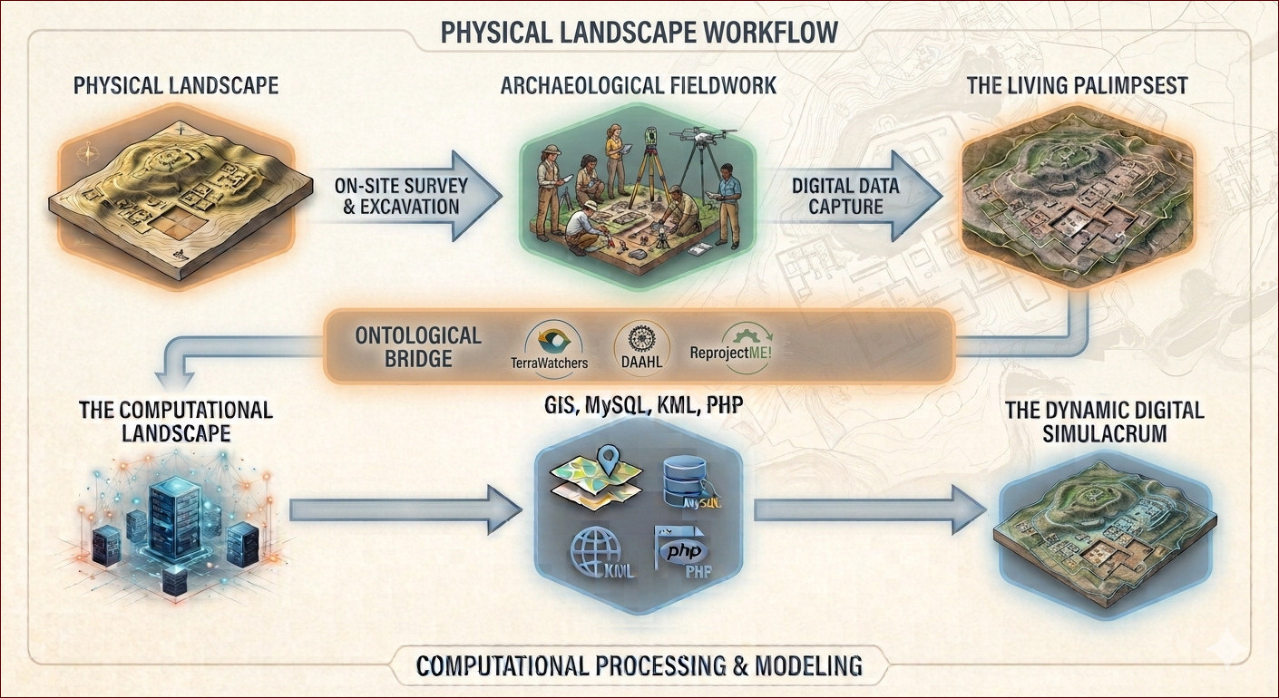
form the theoretical and mechanical scaffolding for our work.
Traditionally, a palimpsest is a piece of parchment scraped clean and reused, leaving faint traces of the original writing visible beneath the new text. The Holy Land is the ultimate physical palimpsest, where over millennia, modern infrastructure has overwritten Crusader, Byzantine, Roman, and Bronze Age layers. By translating these layers into a Geographic Information System (GIS), we digitized this phenomenon. In a spatial database, history is organized into discrete data layers; a user can systematically toggle a layer "on" or "off," peeking through modern pavement to see the ancient landscape beneath. Yet, this digital preservation inherently participates in the creation of a simulacrum--a map that outlasts the territory. As the physical ground becomes increasingly altered or inaccessible due to borders and conflict, the pristine database becomes the primary reality for researchers. The map survives while the resource faces erasure. There is, however, a profound melancholy at the heart of this work. Projects like DAAHL and TerraWatchers are vital efforts against modern impacts to archaeological resources and cultural amnesia, but they also inherently participate in a tragic compromise: accepting that we cannot save the physical world, so we must settle for archiving its ghost in the machine.
Ultimately, this work is an elegiac act of bearing witness to a disappearing world. It is the realization that long after the dust has settled and the physical landscapes have been irrevocably broken, these digital archives will remain as silent monuments to what once was. We are not merely saving data; we are cataloging an inheritance at the very moment it is being destroyed. Each saved record, each verified pixel change, and each clean database response is a quiet, defiant promise that even when a place is wiped entirely from the face of the earth, it will not be allowed to vanish from our memory.
Our Mission
- To help empower national, state and local governments and educational institutions in the discovery, documentation and preservation of their archaeological and historic resources through development and deployment of integrated Cultural Resources information applications using GIS, geodatabase, and web technology.
- To develop GIS, database and web-based methods and techniques to better model and manage cultural resources.
- To provide educational opportunities for students through training workshops in satellite image analysis via crowdsourcing applications like TerraWatchers.